
Garmin Navionics+ Cartography
You’ve never seen Garmin cartography like this before. With integrated coastal and inland content, Garmin Navionics+ and premium Garmin Navionics Vision+ mapping solutions offer a vibrant Navionics style color palette, access to daily map updates, advanced Auto Guidance+™ technology1 and much more. Check chartplotter compatibility.
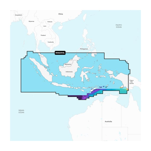
Indonesia and Malaysia - Marine Charts
You’re looking for our best, most up-to-date cartography for your Garmin chartplotter. Get it with Garmin Navionics+ and premium Garmin Navionics Vision+ integrated mapping solutions.
With integrated coastal and inland content, Garmin Navionics+ and premium Garmin Navionics Vision+ mapping solutions offer a vibrant Navionics style color palette, access to daily map updates, advanced Auto Guidance+ technology1 and much more. Check chartplotter compatibility.
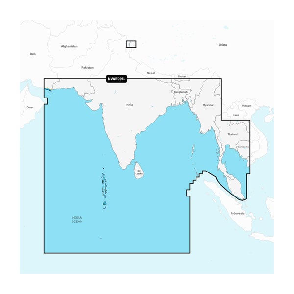
Indian Ocean to Thailand - Marine Charts
You’re looking for our best, most up-to-date cartography for your Garmin chartplotter. Get it with Garmin Navionics+ and premium Garmin Navionics Vision+ integrated mapping solutions.
With integrated coastal and inland content, Garmin Navionics+ and premium Garmin Navionics Vision+™ mapping solutions offer a vibrant Navionics® style color palette, access to daily map updates, advanced Auto Guidance+™ technology1 and much more. Check chartplotter compatibility.
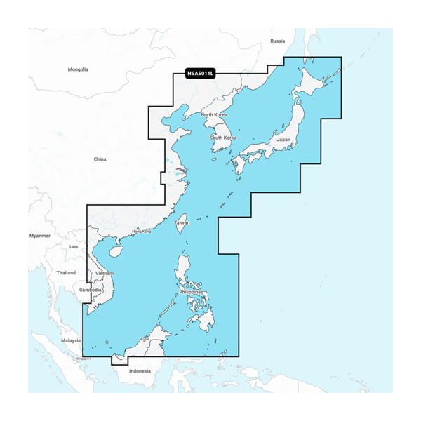
China Sea & Japan - Marine Charts
You’re looking for our best, most up-to-date cartography for your Garmin chartplotter. Get it with Garmin Navionics+ and premium Garmin Navionics Vision+ integrated mapping solutions.
With integrated coastal and inland content, Garmin Navionics+ and premium Garmin Navionics Vision+™ mapping solutions offer a vibrant Navionics® style color palette, access to daily map updates, advanced Auto Guidance+™ technology1 and much more. Check chartplotter compatibility.
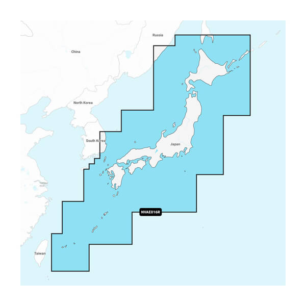
Japan - Lakes and Coastal Marine Charts
You’re looking for our best, most up-to-date cartography for your Garmin chartplotter. Get it with Garmin Navionics+ and premium Garmin Navionics Vision+ integrated mapping solutions.
With integrated coastal and inland content, Garmin Navionics+ and premium Garmin Navionics Vision+™ mapping solutions offer a vibrant Navionics® style color palette, access to daily map updates, advanced Auto Guidance+™ technology1 and much more. Check chartplotter compatibility.
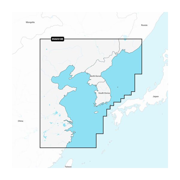
Yellow Sea - Marine Charts Series
You’re looking for our best, most up-to-date cartography for your Garmin chartplotter. Get it with Garmin Navionics+ and premium Garmin Navionics Vision+ integrated mapping solutions.
With integrated coastal and inland content, Garmin Navionics+ and premium Garmin Navionics Vision+™ mapping solutions offer a vibrant Navionics® style color palette, access to daily map updates, advanced Auto Guidance+™ technology1 and much more. Check chartplotter compatibility.
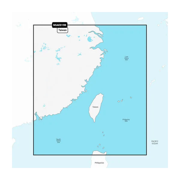
Taiwan - Marine Charts Series
You’re looking for our best, most up-to-date cartography for your Garmin chartplotter. Get it with Garmin Navionics+ and premium Garmin Navionics Vision+ integrated mapping solutions.
With integrated coastal and inland content, Garmin Navionics+ and premium Garmin Navionics Vision+™ mapping solutions offer a vibrant Navionics® style color palette, access to daily map updates, advanced Auto Guidance+™ technology1 and much more. Check chartplotter compatibility.
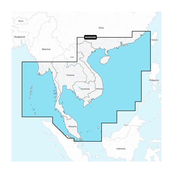
South China & Andaman Seas - Marine Charts
You’re looking for our best, most up-to-date cartography for your Garmin chartplotter. Get it with Garmin Navionics+ and premium Garmin Navionics Vision+ integrated mapping solutions.
With integrated coastal and inland content, Garmin Navionics+ and premium Garmin Navionics Vision+™ mapping solutions offer a vibrant Navionics® style color palette, access to daily map updates, advanced Auto Guidance+™ technology1 and much more. Check chartplotter compatibility.
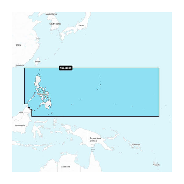
Philippines - Marine Charts
You’re looking for our best, most up-to-date cartography for your Garmin chartplotter. Get it with Garmin Navionics+ and premium Garmin Navionics Vision+ integrated mapping solutions.
With integrated coastal and inland content, Garmin Navionics+ and premium Garmin Navionics Vision+™ mapping solutions offer a vibrant Navionics® style color palette, access to daily map updates, advanced Auto Guidance+™ technology1 and much more. Check chartplotter compatibility.
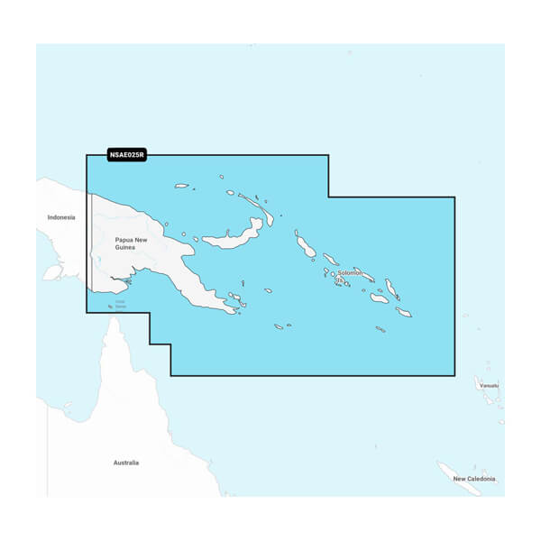
Papua New Guinea & Solomon Islands - Marine Charts
You’re looking for our best, most up-to-date cartography for your Garmin chartplotter. Get it with Garmin Navionics+ and premium Garmin Navionics Vision+ integrated mapping solutions.
With integrated coastal and inland content, Garmin Navionics+ and premium Garmin Navionics Vision+™ mapping solutions offer a vibrant Navionics® style color palette, access to daily map updates, advanced Auto Guidance+™ technology1 and much more. Check chartplotter compatibility.
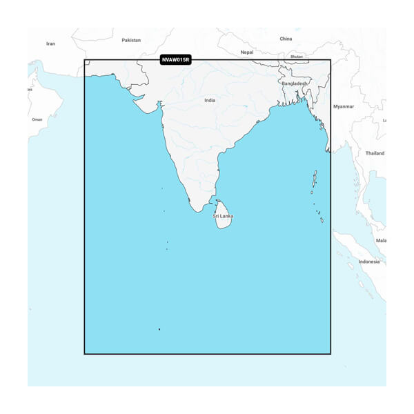
Indian Subcontinent - Marine Charts
You’re looking for our best, most up-to-date cartography for your Garmin chartplotter. Get it with Garmin Navionics+ and premium Garmin Navionics Vision+ integrated mapping solutions.
With integrated coastal and inland content, Garmin Navionics+ and premium Garmin Navionics Vision+™ mapping solutions offer a vibrant Navionics® style color palette, access to daily map updates, advanced Auto Guidance+™ technology1 and much more. Check chartplotter compatibility.